




In the geofences tab of the Group options, users can view or delete geofences and can assign geofences to the groups.
A geofence can have a shape of a circle, a polygon (2-dimensional shape formed with straight lines), or a polyline (one or more paths, a path is a series of connected segments). Geofences are widely used in Flotilla IOT. Geofences can be used in reports, notifications, etc.
Geofence is an area on the map that is important for tracking purposes. User can choose a name, description and color for a geofence. To work with geofences, select the Geofences tab in the main menu. User need to have access right to create, edit, assign and delete geofences. Otherwise, user can only view existing geofences.
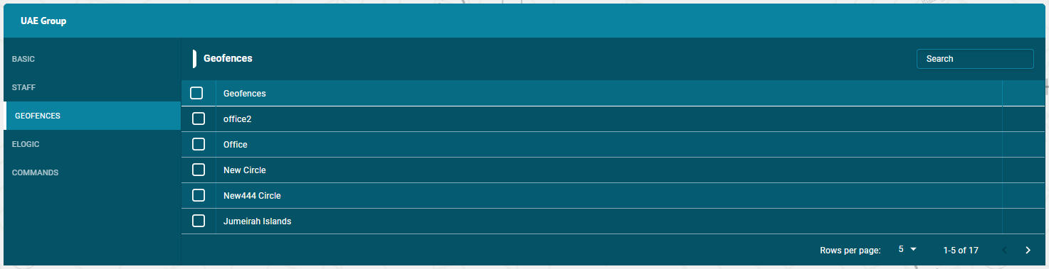
Assign Geofences
- To assign geofences to the groups — Click on the unit and then Geofences tab.
- Click on the check boxes of the geofences to assign this group.
- The geofences with the right tick in the check boxes are those who already have some access to this group.
- The geofences with the empty check boxes are those who doesn’t have access to this group.
Search Geofences
- To find the required geofence in the geofences list, use the search field above geofences list.
- Enter the required geofence name in search field, the result will display.
Delete Geofence
To delete a geofence:
- Select the geofence on the geofences list and click on Delete icon next to the geofence name
- The geofence will be deleted successfully and will not be displayed in the geofences list.